
Geospatial Image And Point Cloud Compression
Octave GeoCompressor (formerly GeoCompressor) is a high performance geospatial image and point cloud compression technology that handles massive datasets without sacrificing quality or speed. It helps organizations manage thousands of high resolution files by turning them into optimized, compressed outputs that are easier to distribute and faster to use. Delivering throughput exceeding 250 MB/sec on standard hardware, it stands as one of the highest performance mosaicking and compression tools available for enterprise data providers.
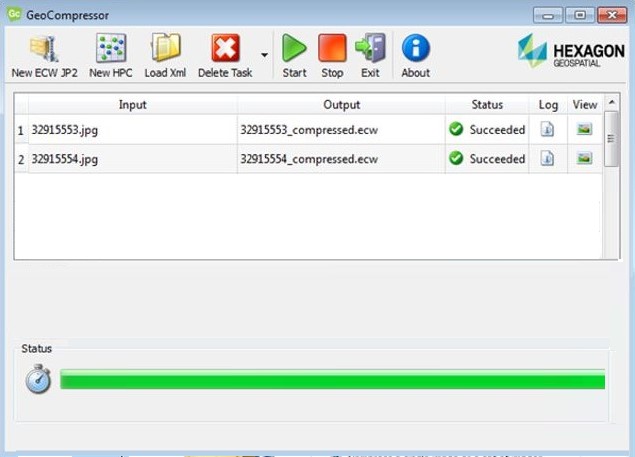
Key Features Of Octave GeoCompressor
Explore the advanced technologies for compressing and processing geospatial data.

Massive Imagery Compression
Reduce the size of immense geospatial images while keeping them visually usable.
- Compress thousands of high resolution files into optimized outputs.
- Retain visual quality after compression.
- Handle terapixel scale datasets on standard hardware.

Intuitive Mosaicking
Facilitate the combination of thousands of individual image files into a single mosaic.
- Create large image mosaics that are easier to manage and distribute.
- Use a guided wizard based workflow to quickly create optimized imagery products.
- Automate the stitching process without complex manual intervention.
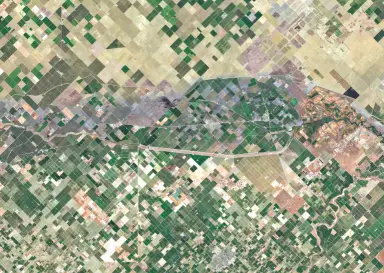
Existing Mosaic Updates
Enable users to update specific areas within an existing mosaic without rebuilding.
- Edit and add new data to existing ECW v3 files.
- Save time and computational resources by updating only a region.
- Eliminate the need to recreate a mosaic from scratch when new data arrives.

Optimized Fast Access
Produce compressed outputs that are ready to display and use immediately.
- Require no additional tiling or cache generation.
- Increase loading and display speeds on server systems.
- Optimize data for seamless viewing and use.
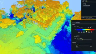
Lightweight Point Cloud Compression
Easily compress large point cloud datasets into efficient formats.
- Accept LAS, LAZ, and E57 inputs from airborne LiDAR data.
- Compress to HSPC format at as little as one tenth the original size.
- Support deployment on web servers for direct access.

Seamless Workflow Integration
Function as a dedicated compression step that complements other tools.
- Integrate into existing processing pipelines smoothly.
- Act as a decoupled component to complete the final compression step prior to delivery.
- Avoid replacing existing GIS or image analysis software.
Octave GeoCompressor Technical Specifications
Processing limits of the geospatial image compression software.
| Metric | Raw imagery | Compressed to ECW |
|---|---|---|
| Dimensions | 3,659,118 by 2,836,274 pixels | Single image file |
| Bands | 4 band, RGB | 3 band, RGB |
| File count | 45.816 image files | 1 file |
| Storage size | 28,996.53 GB uncompressed | 439.67 GB ECW compressed |
ECW delivers up to 94% compression at a 15:1 ratio compared to original file sizes
The output is visually indistinguishable from the original
Input formats: LAS, LAZ, E57
Output format: Hexagon Special Point Cloud (HSPC), tile based structure
Compressed size can be as little as one tenth of the original file
Core Business Values Delivered
The practical economic and operational benefits of deploying the software.
Reduced Data Size
Optimize infrastructure costs and data management.
- Compress large imagery into much smaller files.
- Significantly decrease storage and transfer costs.
- Achieve up to 94 percent compression ratio compared to original file sizes.
Improved Performance
Increase data access and display speeds for end users.
- Load and display imagery faster significantly.
- Work smoothly with massive mosaics.
- Deliver throughput exceeding 250 MB/sec on standard hardware.
Simplified Delivery
Share large datasets easily and conveniently.
- Deliver large datasets without tiling or caching.
- Create single, easy to manage outputs for sharing.
- Support clipping to polygon boundaries for custom products.
Compatible Workflows
Protect technology investments and maintain system continuity.
- Integrate into existing processing pipelines without disruption.
- Complement other geospatial tools rather than replacing them.
- Support both Microsoft Windows and Linux operating systems.
Octave GeoCompressor Packaging Tiers
Three packaging tiers based on processing volume, from moderate needs to unlimited scale.
| Capability | Essentials | Advantage | Professional |
|---|---|---|---|
| Image compression under 250 gigapixels per job | |||
| Image compression under 500 gigapixels per job | |||
| Image compression unlimited per job | |||
| Image mosaicking up to the gigapixel limit | |||
| Batch image compression up to the gigapixel limit | |||
| Point compression unlimited | |||
| ECW v3 region update | |||
| Concurrent license | |||
| Subscription only | |||
| CPU thread limit per job | 4 threads | 8 threads | Unlimited |
Industries Applying Octave GeoCompressor
Sectors managing and distributing large scale geospatial data.

Data Providers
Optimize the geospatial data distribution process for clients.
- Compress massive datasets for easy sharing and downloading.
- Create single mosaics from thousands of satellite or aerial image files.
- Significantly reduce storage costs and server bandwidth.

Mapping Agencies
Process and store large scale maps with high accuracy.
- Manage large orthophoto and elevation model datasets.
- Update regional maps quickly without reprocessing the entire dataset.
- Ensure map data is always ready for GIS systems.

Environmental Monitoring and Spatial Data Infrastructure
Applications following the CAR Cundinamarca model of environmental smart monitoring.
- Build spatial data infrastructure for environmental change monitoring
- Quickly update new data regions within an existing mosaic on monitoring cycles
- Share data with multiple stakeholders on a web platform
Frequently Asked Questions About Octave GeoCompressor
A dedicated software for compressing and optimizing large scale image and point cloud datasets.
- – Helps reduce file sizes while keeping data easy to store and share.
- – Supports fast data display without sacrificing quality.
- – Ideal for organizations managing geospatial data.
It is a focused compression and mosaicking application, not a full GIS solution.
- – Focuses on the final data compression and delivery step.
- – Complements existing GIS or image analysis software.
- – Does not provide spatial extraction or analysis tools.
The software is designed to handle datasets difficult to manage with general tools.
- – Supports large scale geospatial imagery.
- – Supports point cloud data from LiDAR.
- – Optimized for terapixel datasets and billions of points.
Octave GeoCompressor is intended to complement existing processing workflows.
- – Acts as a dedicated compression step in the pipeline.
- – Does not require replacing existing GIS or photogrammetry software.
- – Enhances final data delivery performance.
Octave GeoCompressor is intended to complement existing processing workflows.
- – Acts as a dedicated compression step in the pipeline.
- – Does not require replacing existing GIS or photogrammetry software.
- – Enhances final data delivery performance.
Octave GeoCompressor is specifically designed for immense datasets.
- – Combine thousands of image files into large optimized mosaics.
- – Allow updating parts of an existing mosaic.
- – Smoothly process terapixel scale images.
The software supports integration into automated processing pipelines.
- – Functions as a dedicated compression step in automated workflows.
- – Supports batch processing without manual intervention.
- – Compatible with workflow management systems.
Contact For Consultation And Octave GeoCompressor Pricing
Connect with TrueTech experts for detailed technical support.
30 years of experience in surveying technology and engineering software
Deep technical support engineering team
Commitment to enterprise data security and transparency

