
2D/3D/4D Geospatial Analytics Platform
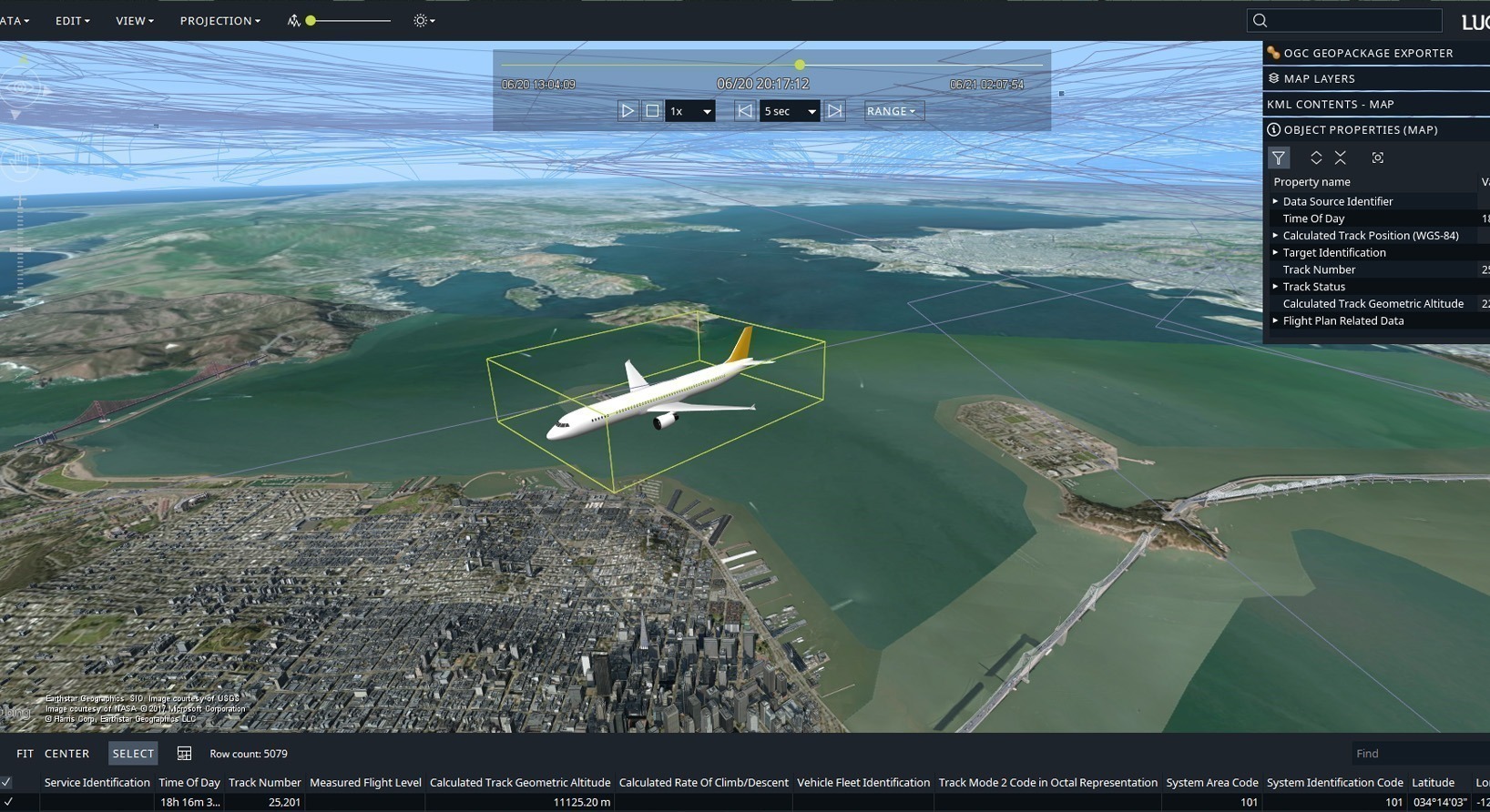
Key Technological Features Of Octave Alto Lightspeed
High Performance 2D/3D/4D Visualization Engine
- Explore large maps, terrain, imagery, and live tracks without any visual lag.
- Seamlessly switch between 2D, 3D, and 4D time based views.
- Maintain fast processing speeds even with heavy datasets or live data through GPU accelerated rendering.
Support For Over 200 Data Formats
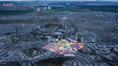
- Supports over 200 geospatial data formats including raster, vector, point clouds, and reality meshes.
- Directly integrates aviation (AIXM), maritime (ENC), defense (ASTERIX), and weather standards.
- Use the Lucy application to drag and drop or connect databases with unparalleled performance.
Visual Analytics Tools
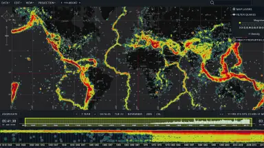
- Configure clustering algorithms to aggregate data into easily distinguishable clusters.
- Use timelines and swipe or flicker tools to compare images and detect changes.
- Create density heat maps and slice multidimensional data for deep spatial analysis.
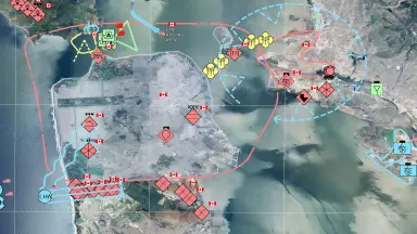
Lucy Application Framework And Customizable SDK
- Use Lucy as a ready to use desktop application framework to get started quickly.
- Customize user interface, symbology, and interaction behavior to your specific needs.
- Extend system capabilities without reworking the entire architecture thanks to the modular SDK.
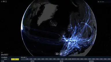
Real-Time Data Feeds and Simulation Replay
- Monitor live events, moving assets, sensors, and radar video in real time
- React quickly with continuously updated operational information from dynamic data sources
- Replay or simulate scenarios to investigate events, train teams, and plan tactical operations, all within the same view
- Leverage playback controls and continuous label decluttering during simulation replay
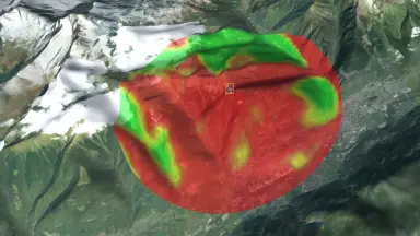
Core GIS Engine with Worldwide Geodetic Accuracy
- Access and represent data in any coordinate reference system: geodetic, geocentric, topocentric, and grid, including vertical datum support
- Perform advanced geodetic calculations, coordinate transformations, and ortho-rectification with high precision
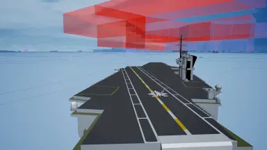
- Support geoid models and complex geometries such as geo-buffers, arcs, arc bands, 3D radar coverage volumes
- Set up geo-fencing for 3D sensor detection range volumes
- Support concurrent data access and asynchronous loading for enhanced performance
Core Benefits of Deploying Alto Lightspeed
The business and operational advantages that enterprises and organizations gain from choosing the Alto Lightspeed geospatial analytics platform.
Unmatched Performance And Real Time Processing
- Experience unprecedented user interaction with hundreds of thousands of track updates per second.
- Perform on the fly line of sight and dynamic density calculations instantly.
- Access and render real time data without costly preprocessing steps.
Worldwide Positioning Accuracy
- Perform precise geodetic transformations and calculations on a global scale.
- Keep data perfectly aligned even in complex projections or polar regions.
- Maintain the highest level of spatial accuracy for all object layers.
Optimized Total Cost Of Ownership (TCO)
- Enable rapid development and customization through a clean source code structure.
- Ensure backward binary compatibility and eliminate the need for data preprocessing.
- Platform independent, running smoothly on any Java supported OS (Windows, Mac, Linux).
Core Features (Essential, Advanced, Pro)
| Capability Group | Technical Details |
|---|---|
| Core GIS Engine | Projection, datum, and geoid models; transformation and projection engine |
| 4D Geometry Model | Cartesian and geodesic geometry model; unified data model; complex geometry support (geo-buffers, arcs, 3D radar volumes) |
| CPU 2D / GPU 2D/3D Visualization | Accelerated 2D/3D and non-accelerated 2D views; integrated terrain rendering; advanced labeling and decluttering |
| Vertical, Profile & Timeline Views | Vertical View, Profile View, and Timeline View for elevation and dynamic data |
| Customizable Styling | Layers, icons, line styles, fill styles, transparency; OGC SLD/SE support; hardware-accelerated styling expressions |
| CPU/GPU Image Processing | Advanced interactive graphical processing for raster data including HDR and multispectral imagery |
| 2D/3D/4D Interaction Model | Ready-to-use controllers: zoom, pan, select, edit, rotate, distance measurement, multi-touch |
| Visual Analytics | Clustering, data slicing, swipe/flicker, density/heat maps, vertical and profile views |
| High-Quality Large-Format Printing | Configuration, preview, and high-quality snapshot printing with multi-page support |
| Raster & Vector Connectors | Access multiple formats: BIL, BMP, DTED, GeoTIFF, JPEG2000, PNG, ESRI Shape, GeoJSON, CGM, SVG, and more |
| Point Clouds & Reality Meshes | Unlimited connection and visualization; OSGB, LAS, LAZ, E57, OGC 3D Tiles (Draco compression) support |
| OGC Standards | GeoPackage, GML, KML, WCS, WFS(-T), WMS, WMTS, OGC Filter 2.0, SE, ISO 19115, OGC 3D Tiles |
Alto Lightspeed Applications by Industry
A flexible geospatial analytics solution meeting multi-industry needs from defense and aviation to infrastructure management.

Defense And Security
- Full support for military data formats and tactical symbology (APP6, Mil Std).
- Analyze complex airspaces and calculate line of sight on 3D terrain.
- Set up geo fencing and detect anomalies automatically.

Aviation And Air Traffic Management
- Analyze complex airspaces delivered as AIXM data using 3D visualization.
- Display flight procedures, navaids, and minimum off route altitudes (MORA).
- Support dynamic flight planning based on 4D weather data.

Maritime And Infrastructure
- Decode and display electronic navigational charts complying with IHO S 57, S 63, and S 101 standards.
- Import and visualize CAD designs like DWG, IFC, and Revit in a 3D context.
- Prepare 3D city models for streaming via OGC 3D Tiles.
Frequently Asked Questions About Octave Alto Lightspeed
- – LuciadLightspeed has been renamed and integrated into the Octave Alto family with a consistent naming structure.
- – Only the name changed; the product retains the powerful visualization and analytics performance you expect.
- – Continues to provide a 2D/3D/4D geospatial analytics platform for desktop and onboard applications.
- – Designed for high performance rendering and responsive interaction even with heavy imagery and thousands of moving tracks.
- – Handles real time feeds without preprocessing, allowing teams to monitor activity as it happens.
- – Supports playback or scenario simulation for planning or analysis in the same view.
Very fast. Alto Lightspeed is designed for high-performance rendering and responsive interaction, even with heavy imagery, complex terrain, and thousands of moving tracks simultaneously. It also handles real-time feeds without preprocessing, allowing teams to monitor activity as it happens. The platform achieves speeds up to 100 times faster and more accurate than traditional GIS software.
Alto Lightspeed works with 200+ formats across raster, vector, 3D meshes, point clouds, and OGC web services. You can combine data from local storage, network servers, or cloud platforms in a single view, keeping everything aligned and accurate worldwide. Supported formats include GeoTIFF, ESRI Shape, GeoJSON, KML, LAS/LAZ, AIXM, S-57, ASTERIX, and many more.
Yes. Alto Lightspeed supports defense formats and symbology (APP-6A through APP-6E, MS2525b through MS2525d, NVG, ADRG, CADRG, NITF), aviation standards like AIXM (3.3 through 5.1) and ARINC 424, maritime ENC standards (IHO S-57, S-52, S-101, S-63), and weather/environment data (NetCDF, GRIB), allowing teams to work with familiar datasets in one place. Recent updates add S-101 ENC support and APP-6E cyber units.
Yes. Alto Lightspeed’s modular SDK lets developers customize data sources, symbology, tools, and UI behavior. It is designed to fit different system architectures and to evolve over time without a full system redesign, enabling the creation of mission-specific desktop or onboard applications. Contact {{BRAND}} for more details on integration capabilities with your organization’s current systems.
Contact TrueTech - Official Octave Alto Lightspeed Distributor in Vietnam
Our team of experts with 30 years of experience in surveying technology and engineering software is ready to support you.

