
Urban Planning and Construction Order Violation Monitoring Solution
Automated monitoring system using multi-temporal satellite imagery GIS to detect and alert urban planning land use violations across the managed territory.
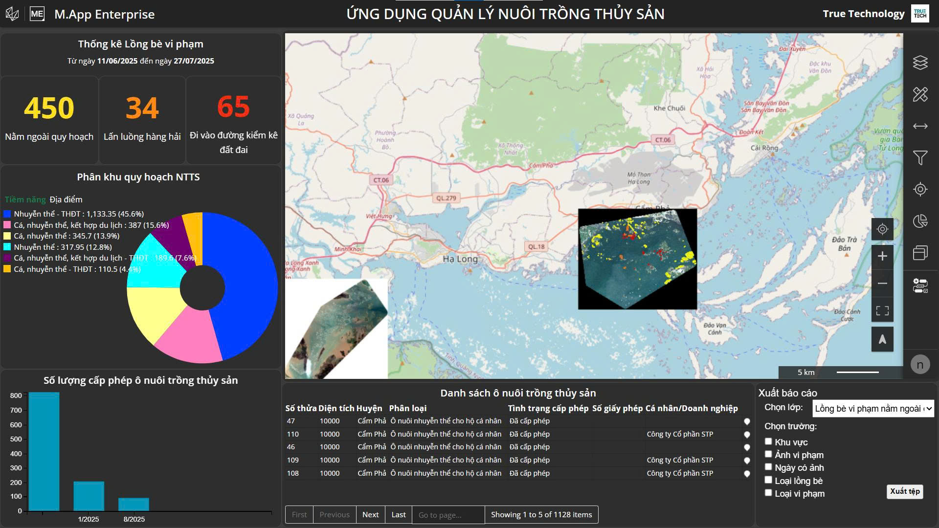
Key Features of Change Detection
Explore 5 core technological features that enable effective monitoring of urban planning and construction order violations.
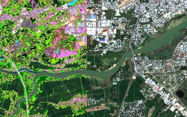
Satellite Imagery Storage and Processing
Large-scale satellite image processing platform with automatic object classification capability.
- The system allows online access to satellite imagery at various time points in different combinations at high speed
- Built-in classification indices enable automatic identification of objects in images including vegetation, residential land, and water bodies according to user needs
- Large-scale data storage and processing capability meets continuous monitoring requirements across the managed territory
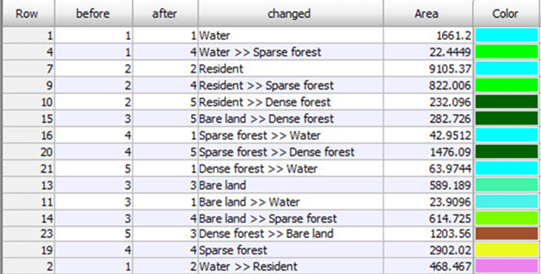
Land Use Change Monitoring
Periodic monitoring and objective reporting of land use changes between time points.
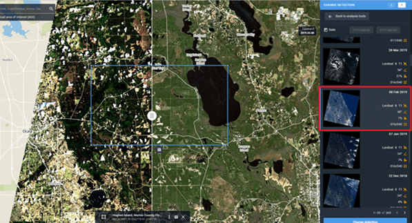
- Enables periodic monitoring and objective, visual reporting of locations with changes in land use function, changed area, and change trends
- Based on automatic analysis results from comparing satellite imagery at two different time points
- Provides detailed statistical data on the rate and extent of land use change over time
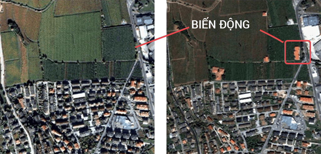
Planning Violation Detection and Alert
Automatic violation detection with instant alerts via email or mobile phone.
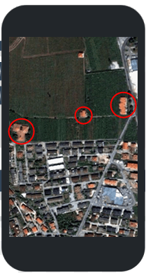
- Allows updating and publicizing land use planning information and construction permits on the system
- Analysis and comparison features between satellite imagery with land use planning maps and construction permit maps enable automatic detection of land use planning and construction order violations
- Automatically sends alerts to management officers via email or mobile phone to help limit and promptly remedy violations
Field Work Support
Mobile application for on-site verification and violation processing with online and offline capabilities.
- Enables field work for verifying violations, inspection, and violation processing in both online and offline modes
- Mobile device application allows management officers to access data and update information directly at violation locations
- Automatic data synchronization when devices reconnect to the system ensures continuous information updates
Data Sharing and Unification
Data sharing platform between units helps save costs and unify management.
- Allows sharing of satellite imagery, data, and digital maps between units, organizations, and individuals in the territory
- Helps save investment costs and unify management data within the same territory
- Creates centralized database ensuring consistency and accessibility for all stakeholders
Distinctive Experience on Cloud Computing Platform
ChangeDetection combines multiple remote sensing and GIS achievements on cloud computing platform, delivering superior benefits to users.
Rapid deployment with immediate field data collection
Mobile Mapping enables fast field deployment, collecting detailed geospatial data directly at the survey site without complex setup.
- The Mobile Mapping System can rapidly and accurately collect geospatial data at high detail levels as the vehicle passes through the survey area
- This is particularly beneficial in urban areas where construction and infrastructure layouts change rapidly, and traditional surveys are largely impractical or severely limited during peak traffic hours
- Multi-sensor integration on a single vehicle reduces field setup time, thereby shortening overall project timelines
- Areas that are inaccessible or hazardous can be mapped efficiently and safely using mobile platforms
High-accuracy, comprehensive and detailed data
The Mobile Mapping System ensures superior output accuracy, covering even underground and underwater structures that traditional methods struggle to reach.
- Data collected is highly accurate and comprehensive, delivering significant value to users and data owners in making decisions based on precise geospatial information
- This technology has been used to survey major road and railway projects, map urban environments, understand underground and underwater structures, and improve safety in infrastructure and power plants worldwide
- Accuracy is ensured through the combination of GNSS and wheel-mounted Distance Measuring Instrument (DMI), particularly critical in urban areas where satellite signals may be blocked by buildings and trees
- The laser scanner collects millions of 3D coordinate points, producing a Point Cloud dataset with density and detail that manual survey methods cannot achieve
Simplified operations, reduced workforce burden
The central control device centralizes the entire workflow, enabling a single operator to effectively monitor and coordinate the entire system.
- Through the central control device, all devices in the system are connected and operated from a single interface, significantly reducing the workload for operators during data collection
- The operational workflow is simpler compared to managing individual devices separately, reducing training time and the risk of errors from manual operation
- Rich data from all sensors is automatically synchronized and stored, and can be processed conveniently in the office either manually or through specialized processing software
Flexible data collection across diverse terrains
Thanks to high customizability and flexible installation, Mobile Mapping systems operate effectively across many terrain types, from urban streets to remote areas.
- Thanks to easy installation and high customizability, Mobile Mapping systems enable data collection across various terrain types, including hard-to-reach areas and complex topography
- The system can be installed on multiple platform types including cars, trains, boats, or backpacks, suited to the specific characteristics of each project and field conditions
- Vast or hazardous areas that were previously inaccessible by traditional survey methods can now be mapped safely and efficiently using mobile platforms
Significantly reduced survey time
Survey time is reduced from weeks to just days, delivering exceptional improvements in project efficiency and productivity.
- Mobile Mapping delivers a superior advantage when vast or hard-to-reach areas can be mapped effectively and quickly using mobile platforms
- Environments that previously took weeks to survey using traditional methods can now be completed in just days with Mobile Mapping technology, significantly enhancing efficiency and productivity
- Rapid data collection enables organizations and businesses to shorten overall project timelines, reducing labor costs and increasing competitiveness
- The mobile mapping system equipped with laser scanners and digital cameras can efficiently and accurately capture road signs, streets, utility grids, and vegetation in a single pass
Industries Applying ChangeDetection
Solution suitable for multiple urban management and land use planning fields.

Urban Management
Monitor urban development according to approved planning.
- Provides comprehensive monitoring tools for provincial and city-level urban management authorities
- Supports early detection of construction order violations in urban areas
- Creates unified database of urban changes for long-term planning work

Land Use Planning
Track and evaluate land use planning implementation across the territory.
- Supports land management authorities in monitoring land use according to planned purposes
- Detects cases of unauthorized land use purpose conversion
- Provides periodic reports on land use planning implementation status

Construction Order
Ensure construction works comply with permits and legal regulations.
- Supports authorities in detecting unpermitted or non-compliant construction works
- Monitors construction process to ensure compliance with construction order regulations
- Provides visual evidence from satellite imagery for violation handling work
Frequently Asked Questions About ChangeDetection
The system automatically analyzes and compares data to detect violations.
- – The system automatically analyzes and compares satellite imagery with land use planning maps and construction permit maps
- – Violation detection feature operates completely automatically based on image analysis and GIS algorithms
- – Detection results are immediately alerted to management officers via email or mobile phone
No installation required, only need network-connected device.
- – Users do not need to install any specialized software on computers
- – Only need a computer or smartphone with network connection to access and utilize data
- – Solution is fully deployed on cloud computing platform to reduce deployment costs and time
Mobile application supports both online and offline modes.
- – Enables field work for verifying violations, inspection, and violation processing
- – Mobile device application operates in both online and offline modes
- – Management officers can access data and update information directly at violation locations
Free access to many imagery sources, pay for premium needs.
- – Users can access many available satellite imagery sources for free
- – Only pay for premium needs including high resolution and frequent update frequencies
- – Significantly saves costs compared to purchasing satellite images separately from providers
System allows data sharing between organizations and individuals in the same territory.
- – Allows sharing of satellite imagery, data, and digital maps between units, organizations, and individuals in the territory
- – Creates centralized database ensuring consistency and accessibility for all stakeholders
- – Helps save investment costs and unify management data within the same territory
Contact for Detailed Consultation About ChangeDetection
TrueTech's team of experts is ready to support the implementation of solutions suitable for your locality or organization.
30 years of experience in surveying technology and engineering software
Dedicated team of technical experts ready for consultation and deployment support
Post-sale technical support and operator training

