
Global Mapper GIS Software - Comprehensive Spatial Data Processing Solution
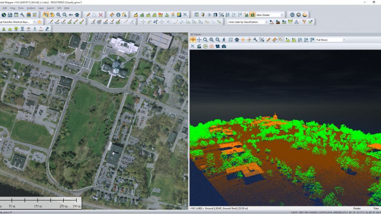
Global Mapper GIS Software Features
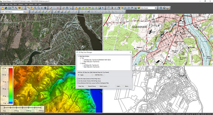
Support for Over 300 GIS Data Formats
- Global Mapper supports importing and exporting over 300 spatial file formats including ESRI Shapefile, KML, GeoTIFF, LAZ and many more, with no add-ons or additional licenses required.
- Users can load, combine, crop, and tile almost any spatial data encountered in their workflows.
- The software continuously adds support for new formats including LAS 1.5, TFADS-O, and GGF, ensuring ongoing data compatibility.
- Direct connection to spatial databases such as PostGIS, MS SQL Spatial, Oracle Spatial, and ESRI Geodatabases via the Connection Manager.
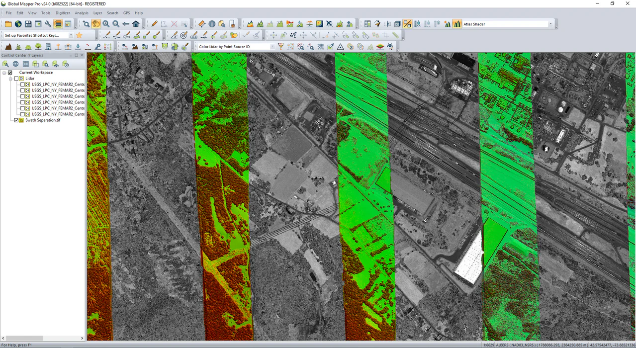
Global Online Data Access
- Global Mapper provides online data access through preconfigured Web Map Service (WMS) and Web Coverage Service (WCS) links.
- The online data repository includes aerial imagery, worldwide elevation data, topographic maps, Landsat satellite imagery, land cover data, and aviation charts.
- Streamed data can be saved locally in formats such as JPEG 2000 for offline use and faster redraw speeds.
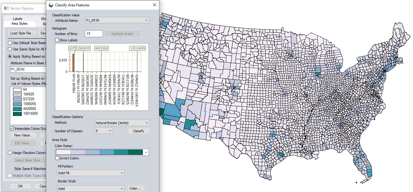
Vector Tools: Drawing, Editing, and Spatial Analysis
- Supports diverse digitizing tools including point, line, and polygon feature creation.
- Specialized geometric tools create buffer zones, coordinate grids, range rings, and other geometric shapes.
- The Spatial Operations tool performs complex vector layer comparisons including Intersection, Union, Difference, and Symmetrical Difference with numerous spatial predicates and transformations.
- Attribute management enables editing, joining, calculation, graphing, and querying of tabular attribute data.
Raster Tools: Multi-Band Imagery Display and Analysis
- Provides tools for multi-band data layer creation, pan sharpening, image tiling, and mosaicking.
- Histogram matching allows the color channel of one layer to dictate adjustment in others, supporting data blending from different collection times or equipment.
- Raster calculation enables mathematical operations on multi-band imagery or multiple data layers, with built-in formulas for NDVI, NDWI, NBR, and custom formulas.
- The Raster Reclassify tool converts pixel values based on user-defined rules.
3D Terrain Analysis and Elevation Modeling
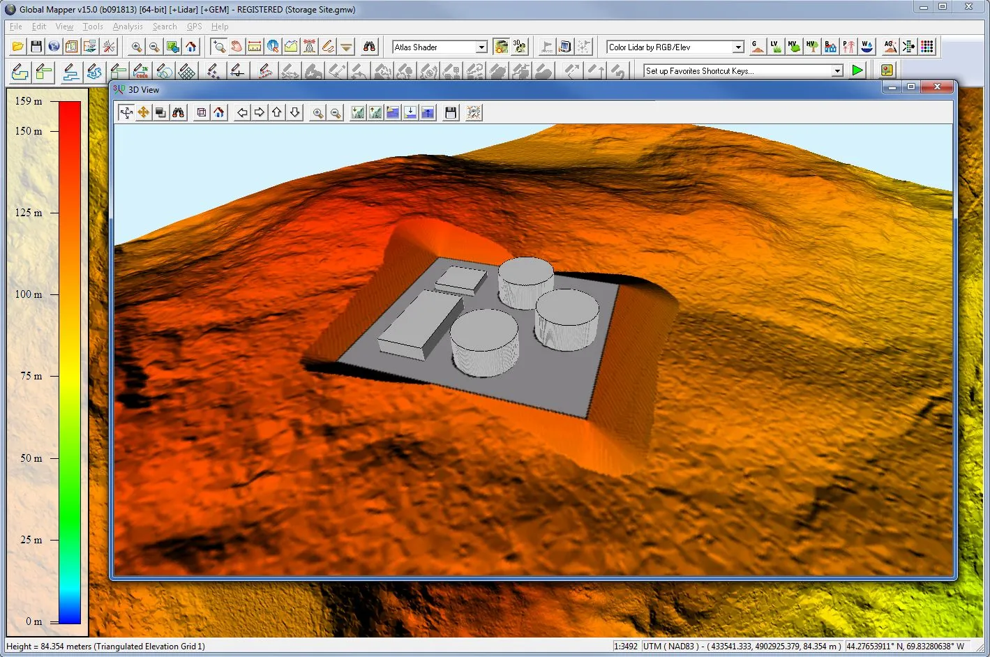
- Dynamic terrain visualization supports imported elevation data and TIN layers generated from 3D vector data with colorful shader options.
- Watershed analysis delineates areas to determine stream paths and drainage or catchment areas.
- Water level rise and potential flooding assessment from loaded terrain data.
- Cut-and-fill volume calculations from polygon or linear features, including pile volume estimation and change detection.
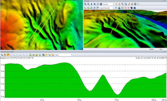
- Cross-section profile views from any linear feature on the map, calculating elevation statistics and slope.
- Line-of-sight analysis and viewshed calculations identify obstructed or visible areas within a specified radius.
3D Rendering and Fly-Through Video Recording
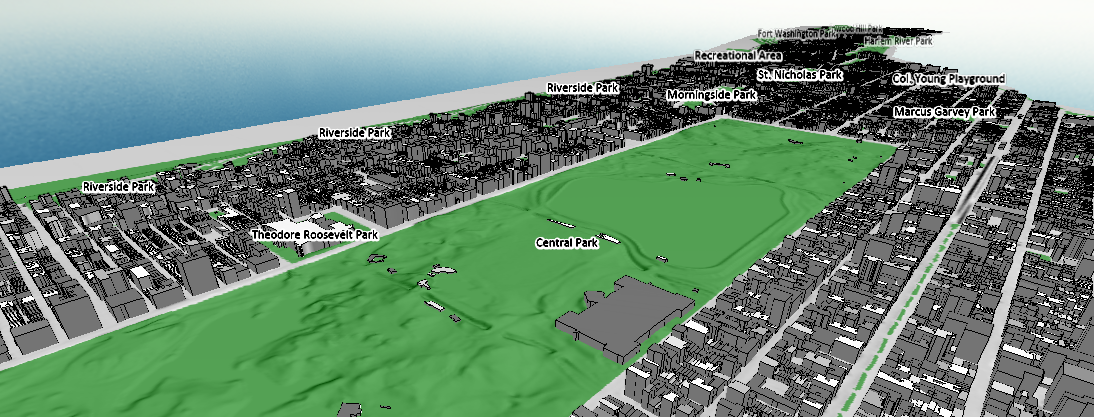
- Global Mapper converts 2D elevation data and height-attributed vectors into an interactive 3D perspective viewer.
- HD fly-through video recording from 3D flight paths defined by line features, enabling easy sharing of point cloud, elevation, and draped raster visualization.
- High-resolution screenshot capture and 3D data video recording.
- Map Layout Editor designs publication-ready maps with titles, legends, scale bars, and multi-page map books.
- GeoPDF export preserves layer visibility, coordinate tracking, and measurement tools.
- Map data export to web tile formats.
Scripting Automation and Batch Processing
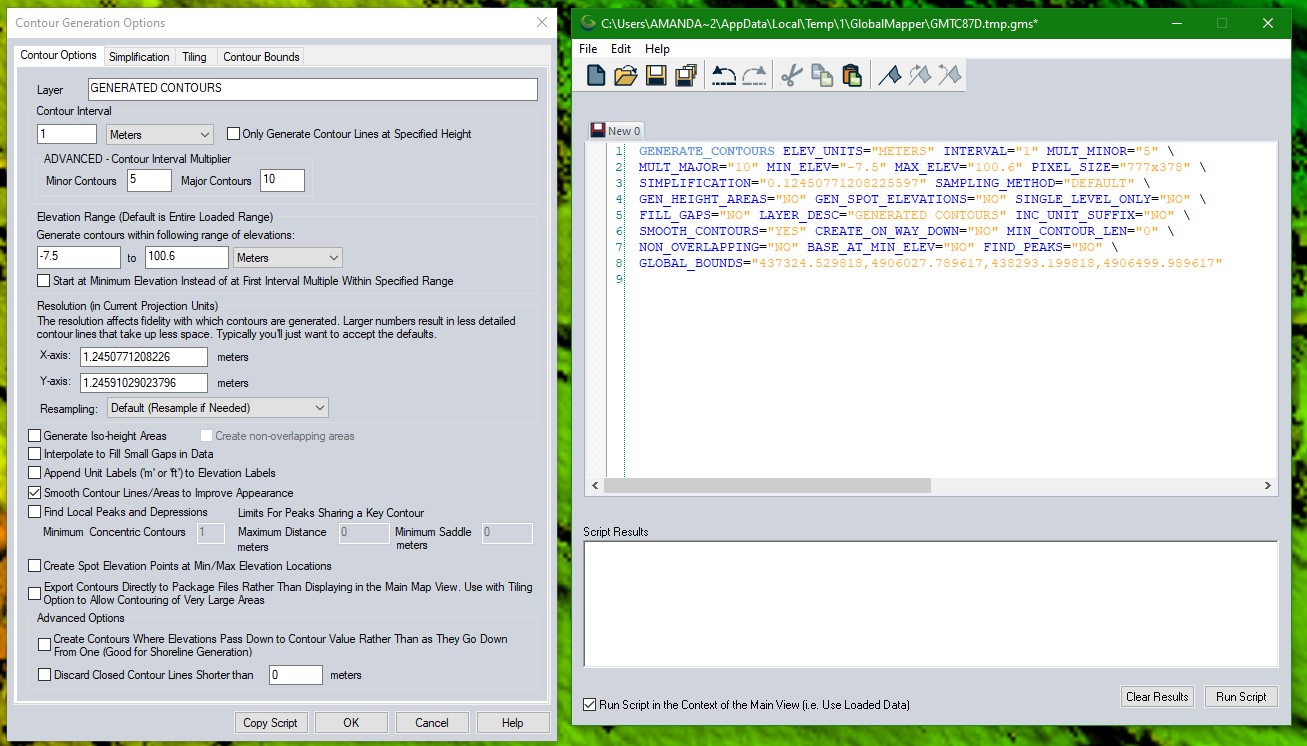
- Users can build Global Mapper Scripts to automate importing, converting, reprojecting, analyzing, calculating attributes, splitting layers, and exporting data.
- Favorite scripts can be saved and executed with the touch of a button.
- Batch processing allows converting, reprojecting, gridding, and renaming multiple files simultaneously without rendering data in viewers.
- The Pro version adds a built-in script editor, Script Builder tool that records actions into Global Mapper Script, and Python v3.9 integration for advanced automation.
Core Values of Using Global Mapper GIS Software
Superior Data Compatibility
- Global Mapper allows loading, combining, cropping, and tiling almost any spatial data encountered, spanning vector, raster, elevation, and point cloud types.
- Data format support requires no add-ons or additional licenses, reducing costs and simplifying license management.
- Format support continuously expands, ensuring the software remains compatible with the latest industry data.
Intuitive Interface, Low Learning Curve
- Intuitive user interface with menus, toolbars, dockable windows, and the main map window organized logically.
- Control Center manages all loaded data layers, enabling visibility toggling, layer grouping, and quick access to properties.
- Global Configuration dialog controls measurement units, coordinate reference systems, 3D view properties, and numerous other options.
- Unlimited technical support from Blue Marble Geographics including Knowledge Base, Forum, YouTube channel, and direct email contact.
Affordable Investment
- Global Mapper provides a comprehensive GIS solution starting under $550 (according to Blue Marble Geographics), including complete spatial data processing capabilities without requiring mandatory add-on modules.
- Unlike many GIS solutions on the market, Global Mapper does not charge per utility add-on for core features, helping organizations control deployment costs effectively.
- Network licensing supports enterprise environments, allowing license sharing among multiple users within an organization.
Complete Ecosystem: Desktop, Mobile, and SDK
- Global Mapper Pro: Extends all standard version features with advanced point cloud processing, image and terrain analysis tools, and Python script support.
- Global Mapper Mobile: Free iOS and Android application for field GIS data viewing and collection, displaying any supported data from the desktop software. The Pro version offers extended professional-grade tools.
- Global Mapper SDK: Software development toolkit enabling developers to access most desktop application functionality from existing or custom-built applications, meeting specific project requirements.
- Professional Training: Blue Marble Geographics offers customized training programs, public certification courses, and self-guided learning with data and instructions.
Global Mapper GIS Software Application Industries
Global Mapper serves diverse industries from surveying, energy, and forestry to urban planning and natural resource management in Vietnam.
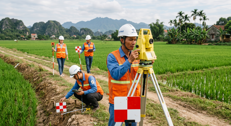
Surveying and Geodesy
- Support for 300+ data formats including LAS, LAZ, GeoTIFF, ESRI Shapefile allows combining data from various collection devices and sources.
- Integrated GeoCalc geodetic library eliminates the need for separate geodetic tools.
- RTK device support and satellite constellation display for precision positioning.
- Contour generation, elevation grid creation, and volume calculation supporting cut-and-fill analysis and terrain mapping.

Energy (Oil, Gas, and Power)
- Energy features provide specialized symbology for the oil and gas industry
- Volumetric calculation supports resource quantity assessment.
- Viewshed and line-of-sight analysis support infrastructure site planning.

Forestry and Natural Resource Management
- NDVI (Normalized Difference Vegetation Index) and NDWI (Normalized Difference Water Index) calculation from multi-band imagery, assessing vegetation health and water resources.
- Watershed analysis delineates catchment areas and stream paths for water resource management.
- Lidar module supports automatic point cloud classification into vegetation, ground, and buildings, with vector feature extraction from classified data.
- Change detection through multi-temporal elevation data comparison.

Urban Planning and Infrastructure Management
- Spatial Operations performs advanced spatial analysis (Intersection, Union, Difference) supporting planning overlay analysis.
- Buffer zones, coordinate grids, and range rings support distance analysis and influence area assessment.
- 3D rendering and fly-through video recording help visualize planning proposals for meetings and presentations.
- Interactive GeoPDF export preserves data layers and measurement tools, convenient for sharing with non-GIS stakeholders.

Remote Sensing and Satellite Imagery Processing
- Histogram matching adjusts color channels between differently collected data layers, combined with feathering and contrast adjustment tools.
- Pan sharpening enhances multi-band satellite imagery by integrating panchromatic data.
- Pixels-to-Points (Pro feature) creates 3D point clouds, orthoimages, and textured 3D meshes from overlapping UAV/drone imagery.
- Advanced automated vectorization from imagery and terrain (Pro feature).
Frequently Asked Questions About Global Mapper GIS Software
Global Mapper supports importing and exporting over 300 spatial file formats including vector (ESRI Shapefile, KML), raster (GeoTIFF), elevation, and point cloud (LAZ, LAS) types. No add-ons or additional licenses are required for any format. New formats such as LAS 1.5, TFADS-O, and GGF are continuously added through updates.
Global Mapper Standard includes all core GIS features: 300+ format support, online data access, vector and raster tools, terrain analysis, volume calculation, 3D rendering, and script automation. Global Mapper Pro adds advanced capabilities: automatic point cloud classification (ground, vegetation, buildings, power lines, poles), vector feature extraction, Pixels-to-Points UAV imagery processing, Python v3.9 integration, built-in script editor, RTK device support, and advanced analysis such as variography and kriging.
Yes. Global Mapper provides two automation methods. First, Global Mapper Scripts allow building text-based scripts to automate importing, converting, reprojecting, analyzing, calculating attributes, and exporting data. Second, batch processing handles multiple files simultaneously. The Pro version further extends this with Python v3.9 integration and the Script Builder tool that records actions into scripts.
Pixels-to-Points is a feature integrated within the Lidar Module (included in Global Mapper Pro) that creates 3D point clouds from overlapping images collected by drones or UAVs. This tool uses photogrammetric algorithms to generate 3D point clouds, orthoimages, and textured 3D meshes.
Global Mapper provides a comprehensive terrain analysis toolkit including: customizable contour interval generation, watershed delineation for drainage area identification, flood simulation and water level rise assessment, cut-and-fill volume calculations, cross-section profile views with elevation and slope statistics, line-of-sight analysis, and viewshed calculations identifying visible or obstructed areas within a specified radius.
Global Mapper Mobile is a free application for iOS and Android devices that enables field GIS data viewing and collection. The application displays any supported data from the desktop version, enables efficient field data collection, and transfers data back to the desktop software. Global Mapper Mobile Pro offers additional professional-grade tools.
Contact TrueTech for Global Mapper GIS Software Consultation
Receive in-depth consultation and pricing for Global Mapper GIS software from TrueTech's expert team with over 30 years of experience.

