
Real-Time 2D/3D Web GIS SDK
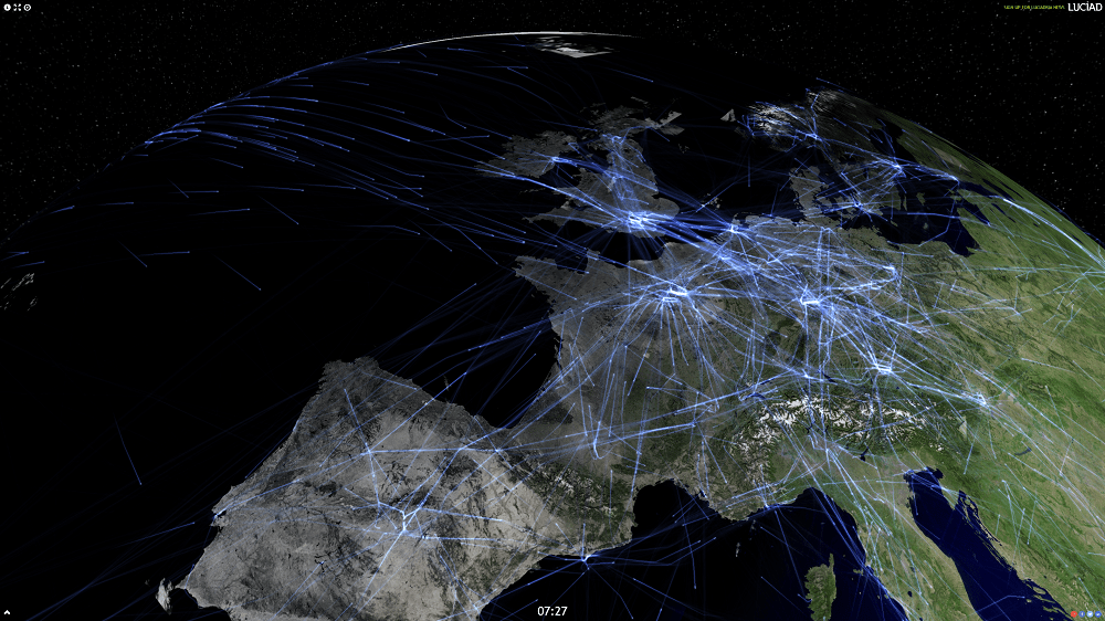
Key Features of Octave Alto Browser
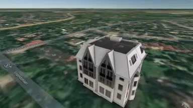
Seamless 2D to 3D switching with a single click
- Switch from 2D to 3D view in a single action without changing source code or input data. Users explore maps instantly in their preferred mode.
- Display detailed 3D models including terrain, buildings, meshes, point clouds, and panoramic imagery for comprehensive spatial understanding.
- Explore 3D scenes naturally, understand geographic locations in depth, and work within realistic digital twin environments.
- Leverage world-scale accuracy to visualize, transform, and compute geospatial data across any region.
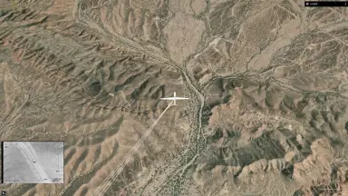
Real-time dynamic data processing and 4D analysis
- Monitor moving objects such as flights, vessels, and vehicles with continuously updated data in real time.
- Manage high volumes of updates with clarity and traceability, suitable for mission-critical operations.
- Combine temporal data to perform 4D analysis, visualizing what has happened and what will happen at any given point in time.
- Analyze millions of events or positions visually and directly from the browser, with the speed and accuracy required for mission planning.
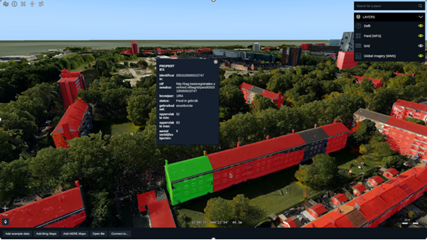
Hardware-accelerated visualization with WebGL technology
- Integrate WebGL hardware acceleration for enhanced 3D visualization with high performance in the browser.
- Develop applications for both 2D and 3D through a single API, reducing development time and cost.
- Load and respond to map interactions quickly even with large data volumes. Users switch between 2D and 3D instantly without interruption.
- Maintain positional accuracy at all times. When zooming, rotating, or changing perspectives, the system handles positioning and coordinate transformations automatically.
Multi-source data integration without ETL conversion
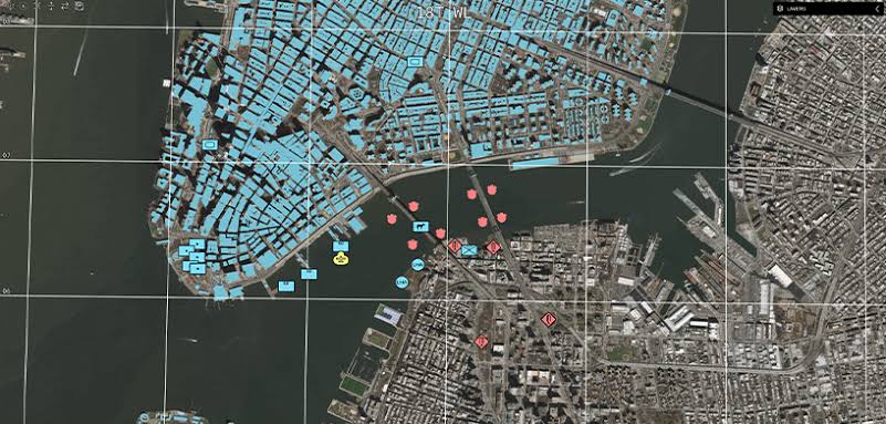
- Connect through standard OGC web services or drag-and-drop commonly used file formats. The system automatically recognizes data and enables exploration in 2D or 3D.
- Overlay data and maps across different projections without ETL conversion processing.
- Combine content from multiple sources into a single, intelligent digital representation of reality.
- Leverage HTML5 technology to deliver high-performance imagery alongside vector-based data and dynamic content.
Extensible and customizable web GIS SDK
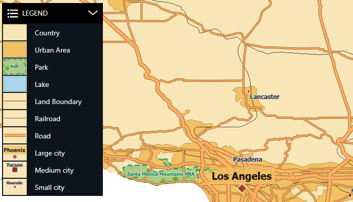
- Modular SDK includes practical examples, guides, and ready-to-use components that help development teams build applications matching specific operational requirements.
- Customize the interface, tools, and application behavior to fit each organization's workflows and data sources.
- Develop easily for networked and cloud-based environments. Integrate seamlessly with other rich internet applications.
- Support touchscreen controls on mobile devices and tablets, enabling use across multiple platforms in the field and in the office.
MIL-STD-2525 and APP-6 military symbology support
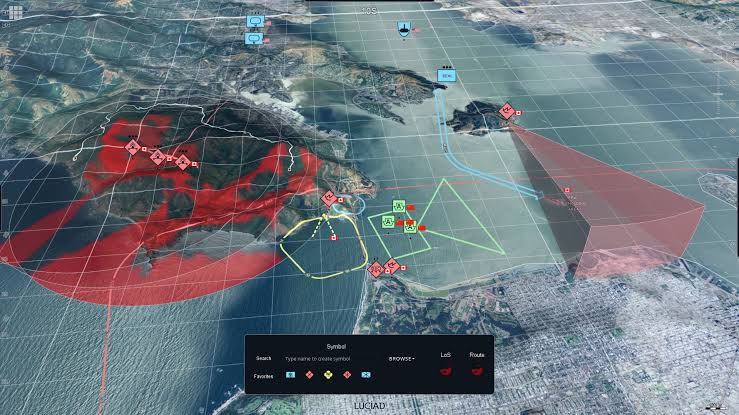
- Full support for the MIL-STD-2525 military symbology standard from the U.S. Department of Defense and NATO's APP-6 standard directly within browser-based applications.
- Deploy tactical and situational displays on web platforms without installing specialized software on individual workstations.
Core advantages of choosing Octave Alto Browser
Key benefits that help organizations optimize their workflows with geospatial data
Desktop performance on a web platform
- Delivers desktop-class performance for web applications, eliminating the need to install heavy software on every workstation across the organization.
- Users access and interact with geospatial data directly from any browser on desktop or mobile devices without technical barriers.
- Maintains continuous responsiveness even with large datasets, preventing delays during data exploration and analysis workflows.
Accurate and dependable visualization
- Maps maintain real-world positional accuracy when zooming, panning, rotating, or switching between different view modes.
- The system handles positioning and coordinate transformations automatically in the background, ensuring information remains trustworthy for decision-making.
- Leverages world-scale accuracy to compute and visualize vector data, satellite imagery, and time-varying dynamic data.
Extensibility and future readiness
- Develop applications easily for networked and cloud-based environments, integrating seamlessly with other rich internet applications and enterprise systems.
- Modular SDK enables customization and extension according to specific needs, from display styling to data connectors and symbology.
- Built on open web standards HTML5 and JavaScript, ensuring compatibility with modern browsers and devices for long-term viability.
Built for mission-critical operations
- Processes geospatial data with the speed and accuracy required for mission planning in complex and time-sensitive scenarios.
- Visualizes millions of events or positions directly from the browser, meeting the demands of critical operations where timely information is essential.
- Supports international defense symbology standards MIL-STD-2525 and APP-6, meeting tactical display requirements in operational environments.
Industries served by Octave Alto Browser
Web GIS solution for sectors requiring geospatial visualization and real-time data processing

Defense and security
- Full support for MIL-STD-2525 and APP-6 defense symbology standards, enabling NATO-standard tactical displays directly in web applications without specialized software installation at each access point.
- Visual analysis of millions of events and positions in real time, supporting mission planning with high accuracy from any browser on any device.

Civil aviation
- Track aircraft movements with continuously updated data, managing high volumes of updates with clarity and individual flight traceability.
- Display accurate aviation maps with seamless switching between 2D and 3D modes, integrating data from multiple sources without ETL conversion.

Maritime and shipping
- Process real-time dynamic data for vessel tracking, displaying positions and routes on accurate nautical maps with continuous updating capability.
- Overlay data from multiple sources across different map projections without ETL conversion, suitable for monitoring vast maritime zones with multiple information layers.

Transportation and logistics
- Track vehicle and mobile asset positions in real time with continuously updated data, suitable for managing large-scale fleets across wide geographic areas.
- Build customizable browser-based interactive interfaces with touchscreen support for mobile devices, serving both field personnel and office-based managers.
Frequently asked questions about Octave Alto Browser
Yes. Octave Alto Browser is the new name for LuciadRIA. The product is developed by Octave, formerly known as Luciad. Functionality and API compatibility remain intact; only the brand name has been updated to reflect the new product strategy. Organizations currently using LuciadRIA can upgrade to Octave Alto Browser seamlessly.
No. Octave Alto Browser runs entirely in a standard web browser with no additional software installation required. Users only need a browser that supports WebGL to access all features, including 3D visualization and real-time tracking. This makes it ideal for organizations seeking rapid deployment without infrastructure investment for software installation.
Octave Alto Browser is specifically designed for real-time dynamic data. The system tracks moving objects such as flights, vessels, and vehicles, managing high volumes of updates without degrading performance. The product is suited for mission-critical operations that depend on continuous real-time information with high traceability.
Yes. Octave Alto Browser supports detailed 3D models including terrain, buildings, meshes, point clouds, and panoramic imagery. Users explore 3D scenes naturally, understand geographic locations in depth, and work within realistic digital twin environments for comprehensive spatial analysis.
Yes. Octave Alto Browser maintains real-world positional accuracy when zooming, panning, rotating, or changing perspectives. The system handles positioning and coordinate transformations automatically. The product processes geospatial data with the speed and accuracy required for mission planning and strategic decision-making.
Octave Alto Browser connects to standard OGC web services and accepts drag-and-drop files in commonly used formats. The system automatically recognizes data and enables exploration in 2D or 3D. The modular SDK supports custom data connectors for specific requirements. Contact TrueTech for a complete list of supported formats for your particular use case.
Contact TrueTech for Octave Alto Browser consultation
TrueTech's expert team is ready to help your organization deploy the right web GIS solution

