
Cross-Platform Geospatial SDK for Mission-Critical Applications
Octave Alto Universal, the solution that inherits and upgrades from LuciadCPillar. This is a powerful set of APIs for the C++ and C# and Android developer community, meeting the needs of building command and control and location intelligence applications that require absolute precision.
Key Features Of Octave Alto Universal
Explore the core technologies that help developers build powerful digital mapping solutions.
Core GIS Engine
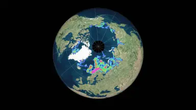
Access and represent data in any coordinate reference system with advanced geodetic calculations.
- Support geodetic, geocentric and projected reference systems.
- Perform accurate coordinate transformations and spatial calculations.
- Integrate a shared C++ core engine across all platforms.
High Performance 2D and 3D and 4D Visualization
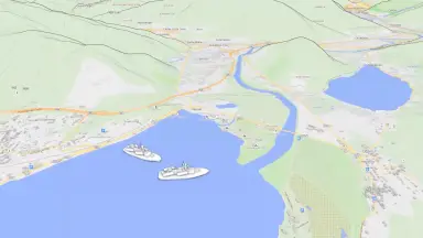
Display multilayered data in two or three dimensions with a modern rendering engine.
- Use the same code base to render two dimensional and three dimensional maps.
- Leverage WebGPU to smoothly render thousands of moving objects.
- Support terrain, imagery, vector and dynamic track rendering.
Real Time Data & Visual Analytics
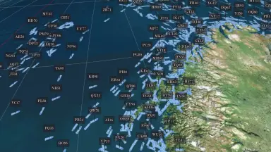
Track thousands of moving assets and analyze behavior in real time.
- Update hundreds of thousands of track positions per second without preprocessing.
- Create heat maps based on static and dynamic data.
- Perform interactive viewshed calculations based on elevation data.
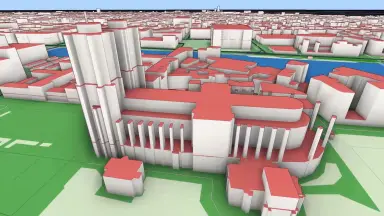
Point Clouds & Reality Meshes
Connect and visualize high detail three dimensional reality models.
- Load and visualize unlimited point clouds and reality meshes.
- Support OGC 3D Tiles format including Draco compression.
- Combine three dimensional data with terrain and spatial annotations.
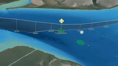
Defense Symbology
Comply with the latest military standards for displaying and creating tactical symbols.
- Support lookup, creation and editing of symbols directly on the map.
- Fully compatible with APP6 and MS2525 standards.
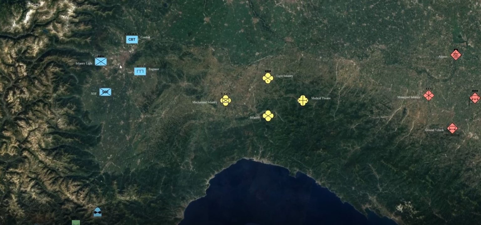
- Display unit symbols and tactical graphics in both two and three dimensions.
Technical Specifications And Supported Formats
Details of programming platforms and data standards integrated out of the box.
Programming Languages
Raster Formats
Platform
UI Frameworks
Jetpack Compose
Elevation Formats
3D & Point Clouds
Military Symbology Standards
Benefits of Deploying Octave Alto Universal
The outstanding economic and technical benefits when deploying the solution in practice.
Best In Class Performance For Large Datasets
Ensure a smooth user experience with massive data volumes.
- Process hundreds of thousands of track updates per second.
- Access real time data without going through preprocessing steps.
- Maintain stable frame rates when rendering thousands of dynamic objects.
Retained Geospatial Positioning Accuracy
Maintain data alignment and reliability on a global scale.
- Ensure absolute accuracy when transforming between coordinate systems.
- Support complex geometric calculations on the earth surface.
- Retain geospatial positioning for all projections and visualizations.
Cross Platform Flexibility
Optimize customizability and interoperability across multiple operating systems.
- Deploy applications on Windows, Linux and Android from a common code base.
- Freely choose the user interface toolkit that fits your enterprise.
- Reuse business logic through a consistent API.
Lowest Total Cost Of Ownership
Build efficient and sustainable applications with rapid development times.
- Accelerate development thanks to a clean modular architecture.
- Ensure source code compatibility when upgrading versions.
- Minimize maintenance and customization costs for specific requirements.
Octave Alto Universal Industry Applications
Flexible solutions meeting the specific needs of each sector.

Defense And Security
Build command and control systems that require absolute reliability.
- Plan missions with high geospatial accuracy.
- Display situational awareness in disconnected environments.
- Use standard military symbology for tactical coordination.

Aviation And Transportation
Manage and monitor traffic flow with continuous dynamic data.
- Monitor flight paths and maritime routes in real time.
- Analyze movement behavior and predict traffic congestion.
- Integrate aviation and maritime data into a common operating picture.

Asset And Infrastructure Management
Monitor and maintain critical facilities with three dimensional models.
- Combine point clouds and reality meshes for condition inspections.
- Track the location and status of thousands of distributed assets.
- Analyze viewshed and environmental impacts on infrastructure.
Frequently Asked Questions About Octave Alto Universal
LuciadCPillar has been renamed to Octave Alto Universal with valuable upgrades.
- – The product retains the cross platform SDK foundation and core capabilities.
- – Adds a modern WebGPU rendering engine and support for more data formats.
- – Continues to deliver high performance for demanding geospatial applications.
The APIs are designed for broad compatibility with popular development environments.
- – Support Windows, Linux and Android operating systems.
- – Compatible with C++ combined with Qt, C# combined with WPF or WinUI.
- – Support Android development using Java or Kotlin with Android Views and Jetpack Compose.
The engine is optimized to maintain high performance even with massive data volumes.
- – Smoothly render terrain, imagery and thousands of moving tracks.
- – Support interactive four dimensional time based data exploration.
- – Ensure a continuous and uninterrupted user experience.
The system ensures absolute accuracy for calculations and visualizations.
- – Perform global geodetic transformations and calculations.
- – Keep data aligned and reliable in both two and three dimensional views.
- – Suitable for mission planning and real world operations.
Contact Us for Octave Alto Universal Consulting
Let TrueTech accompany you in deploying Octave Alto Universal. With 30 years of experience in surveying technology and engineering software, we are committed to delivering the most optimal solutions.
Authorized distributor of Octave in Vietnam
Over 30 years of experience in surveying technology and engineering software
In-depth technical team for deployment support and training

