Compress and Deliver Terabyte Scale Geospatial Imagery
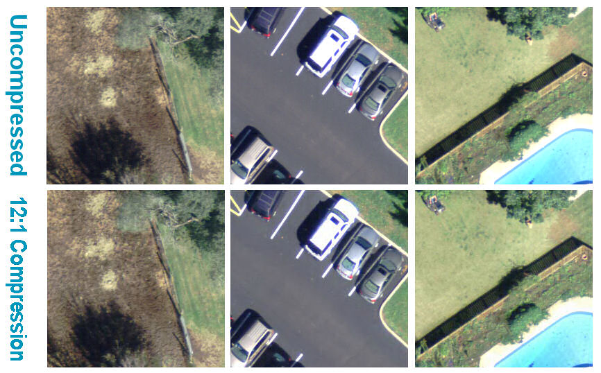
Core Features of Octave ECW Compression
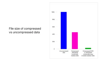
Wavelet Compression Reduces Imagery Size by Up to 95%
- Achieves a 15:1 compression ratio, reducing file size by 94% to 97% at visually lossless quality.
- Delivers the fastest compression and decompression rates in the geospatial industry.
- Preserves high resolution quality at any zoom level and display scale.
- Supports input images up to 250 gigapixels when exporting ECW through ERDAS IMAGINE.
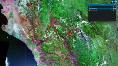
Real Time Imagery Streaming with the ECWP Protocol
- Sends only required pixels, enabling smooth zooming without downloading the full file.
- Supports thousands of concurrent users with minimal latency.
- Reduces bandwidth through intelligent caching.
- Progressive rendering displays imagery rapidly even on slow networks.
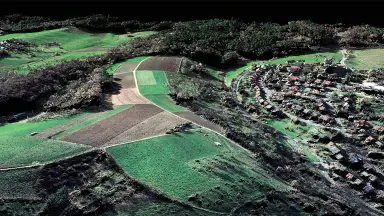
Unlimited Gigapixel and Terapixel Mosaics
- Supports unlimited image sizes with efficient tiled encoding.
- The Set File View capability delivers only the regions or bands requested.
- Builds terabyte scale mosaics optimized for both cloud and on premises infrastructure.
- Eliminates the need to split data into tiles, caches and duplicated variants.
Seamless Integration with ArcGIS and the GIS Ecosystem
- ECW Plugin for ArcGIS Desktop and ECW for ArcGIS Server from Esri.
- Compatible with GeoCompressor, ERDAS IMAGINE, ERDAS APOLLO, GeoMedia and GeoMedia Smart Client.
- Retains geospatial metadata including coordinate systems, datums and projections.
- Works with OGC standards such as WMS and WCS for broad interoperability.
Cloud Ready and Standards Driven Interoperability
- Optimizes imagery storage and delivery on cloud platforms.
- Accesses data on demand by region or by level of detail.
- Standards driven OGC delivery suits public services and enterprise infrastructure.
- Supports cloud workflows, mobile devices and low bandwidth environments.
Core Values Delivered by ECW Compression
Tangible business benefits that help organizations optimize costs, improve operational efficiency, and enable faster decision-making.
Cut Storage Costs by Up to 95%
- Size reduction of 94% to 97% directly cuts disk, SAN and cloud storage costs.
- A single mosaic file replaces tens of thousands of source files and duplicated copies.
- Real proof: a 28,996.53 GB mosaic compressed to 439.67 GB in the South Africa case study.
Faster Delivery and Higher User Satisfaction
- Streaming only the viewed pixels opens imagery instantly even on slow networks.
- Thousands of concurrent users keep minimal latency thanks to ECWP.
- Industry fastest decompression and rendering raise user satisfaction.
Simplified Data Management Workflow
- The conventional workflow requires tiles, pyramids, mosaic overviews and caches, while the ECW workflow needs only one ready to use mosaic file.
- Reduces effort for managing, backing up and synchronizing multiple data versions.
- Consolidates projects into a single file used everywhere, in every software.
Effortless Scalability for Large Organizations
- Supports thousands of concurrent users for distributed teams and field operations.
- Fits public facing services that publish high resolution imagery to citizens.
- Broadly adopted across major image servers, storage platforms and popular GIS applications.
Optimized Cloud and Bandwidth Costs
- Files 15 times smaller directly reduce cloud storage invoices.
- ECWP cuts transfer bandwidth by sending only viewed regions with intelligent caching.
- On demand access by region or scale avoids loading and paying for unused data.
Industries and Application Fields of Octave ECW Compression
ECW Compression serves diverse industries that require high-performance management, delivery, and access to large-scale imagery data.

National Mapping and Land Administration
- Builds national mosaics from tens of thousands of image files into a single ECW file.
- Delivers high resolution base imagery to government bodies and public services.

Defense and Public Safety
- Streams instant field imagery to distributed teams via low bandwidth ECWP.
- Stores massive mission imagery archives at minimal cost with the 15:1 ratio.

Transportation and Infrastructure
- Large corridor imagery loads smoothly for field survey teams and offices.
- Gigapixel corridor mosaics support design and construction progress monitoring.

Utilities: Power, Water and Public Services
- Delivers base imagery to thousands of field workers and dispatch centers.
- Cuts storage costs of periodic inspection imagery archives for grids and pipelines.
Frequently Asked Questions about Octave ECW Compression
It is a set of tools including ECW compression technology, the ECWP streaming protocol, SDKs and GIS plugins, designed to compress, store and deliver massive geospatial datasets efficiently.
It typically reduces raster file sizes by 95% to 97% while keeping visually lossless quality.
The Enhanced Compression Wavelet Protocol is used to stream large imagery datasets rapidly with progressive rendering and low bandwidth usage.
Yes. ECW is widely supported, allowing desktop, mobile and server GIS applications to natively read and serve ECW imagery.
Yes. It supports cloud storage workflows and significantly reduces storage and bandwidth costs for cloud deployments.
It supports ECW, JPEG2000, GeoTIFF metadata and GML georeferencing across Windows, Linux, macOS, Android and iOS.
Yes. It supports gigapixel and terabyte scale mosaics and can deliver them efficiently via ECWP.
Contact TrueTech to Deploy Octave ECW Compression
The TrueTech engineering team is ready to survey your needs, advise on licensing and accompany deployment in Vietnam.

