
A Comprehensive Web Mapping Solution for Enterprise
WebGIS Features
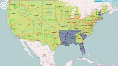
Standards-Based Geospatial Data Publishing
- Publish vector data and raster data as web services compliant with OGC (Open Geospatial Consortium) standards
- Full support for protocols including OGC WMS (Web Map Service), OGC WFS (Web Feature Service) and OGC WMTS (Web Map Tile Service)
- Compliance with INSPIRE and XML standards to ensure interoperability
- Integration of the ECWP high-speed imagery streaming protocol from ERDAS APOLLO
- Share and reuse web services across multiple applications and enterprise systems
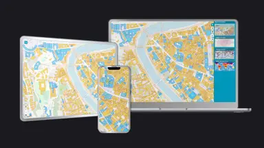
Ready-to-Use Web Mapping Applications
- Geospatial Portal serves as the integrated web client, enabling users to view, analyze, capture and update geospatial information in 2D and 3D
- WebMap Publisher is built into Geospatial Portal, allowing direct web application creation from a GeoMedia GeoWorkspace
- GeoMedia WebMap Essentials provides a simplified version with a streamlined Geospatial Portal interface
- The Advantage and Professional tiers unlock the full functionality of Geospatial Portal
- Users can view, query and analyze multiple geospatial data formats simultaneously without pre-conversion
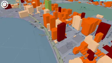
Multi-Source Data Integration in One Web View
- Combine data from multiple services and sources within a single map view
- Native access to Esri File Geodatabase (FGDB) data along with many other data formats
- On-the-fly coordinate transformation enabling the combination of data from different coordinate reference systems
- No pre-publishing or data conversion required, saving processing time
- Additional data type support and transformation capabilities available through GeoMedia Smart Client
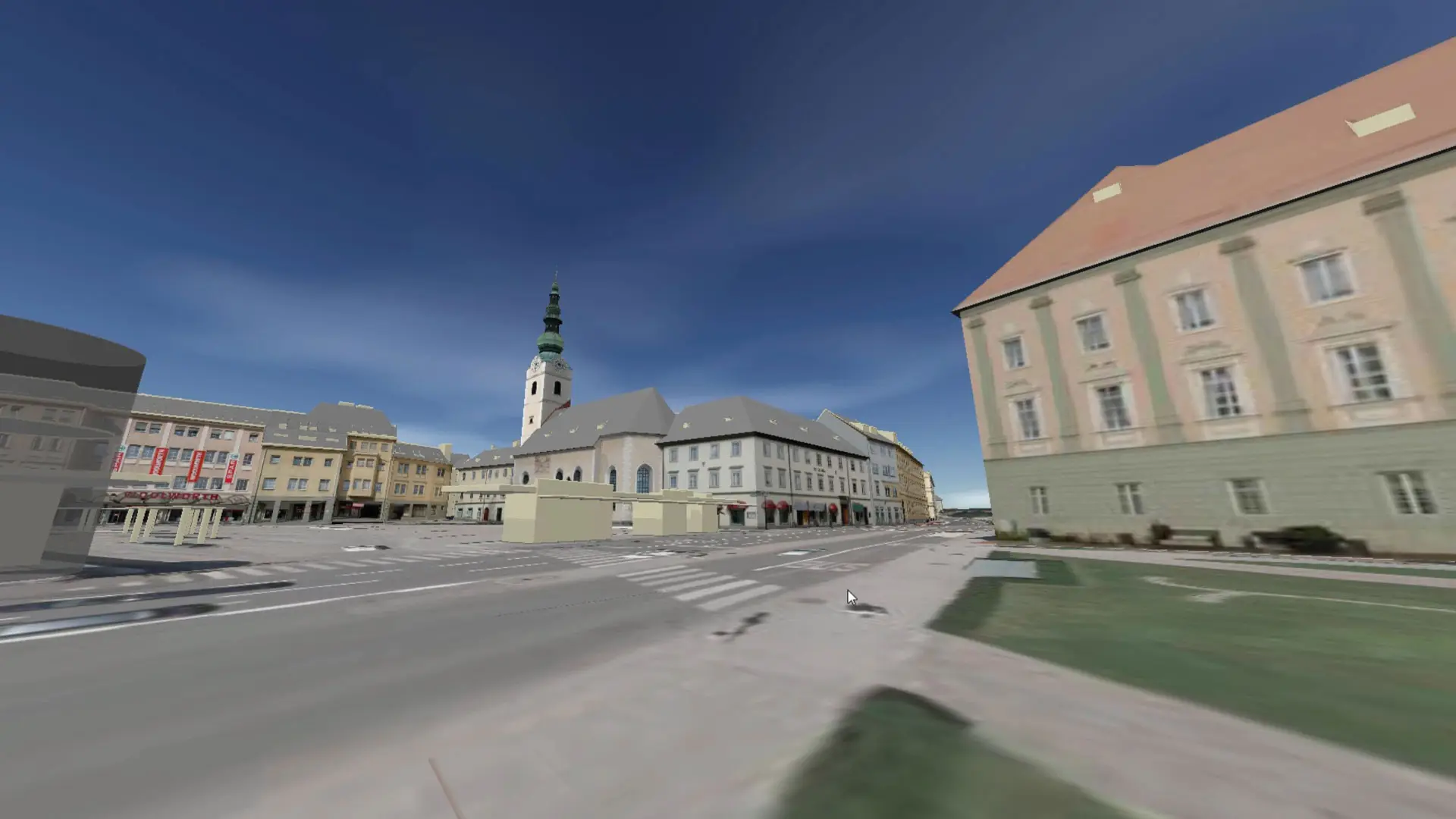
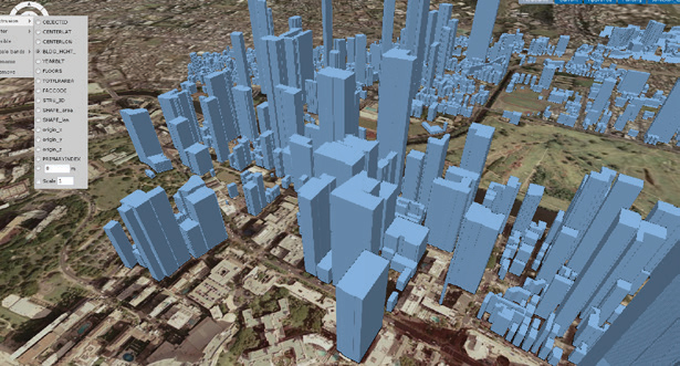
Advanced 3D Visualization
- myVR technology enables instant 3D display on all websites built with GeoMedia WebMap
- mTransformer prepares 3D objects and terrain scenes for visualization, with support for raster data sources such as WMS or WMTS overlaid on terrain
- Vector data can be extruded for 3D display based on the latest warehouse content
- Vector data can also be highlighted to display attribute data through tooltips
- Sunlight and shadow simulation provides an analysis tool for urban planners
- First-person perspective in the 3D view delivers a completely new interactive experience
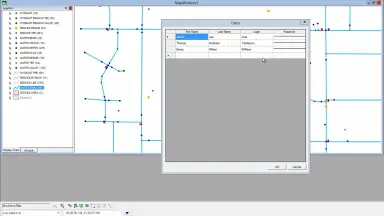
Online Data Editing via Web and Mobile
- Authorized users can update attributes and geometry directly through web or mobile applications
- Full data lifecycle management: from capturing new data, viewing and analyzing existing data, to updating and modifying based on analysis results
- Spatial data is captured in accordance with a central data model and written directly to Microsoft Access, Microsoft SQL Server or Oracle
- Editing capabilities in the Advantage and Professional tiers are implemented within Geospatial Portal
- The OGC WFS-T (Web Feature Service Transactional) standard is used to edit, update and delete features in the database
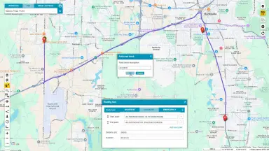
Advanced Spatial Analysis on Web Maps
- General analysis tools include buffer zoning, spatial intersection, spatial difference, analytical merge, aggregation, join, geocoding, reverse geocoding and functional attributes
- Sophisticated analyses such as route analysis (including OpenLS routing), proximity analysis and area allocation
- Dynamic segmentation and linear analysis performed quickly over the web, enabling visualization of assets along linear features on a map
- Network-based analysis directly assesses routes, reachability and movement on web-based maps
- Functional attributes extend customizable analysis capabilities
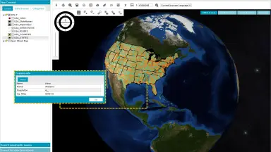
System Administration and Workflow Automation
- Integrated web-based administration console for managing servers, web services and websites from a single graphical interface
- Administrators can modify server configuration parameters and test websites and web services in real time
- Workflow Manager enables attribute-focused business processes for government agencies, utility companies and enterprise users, accessible from the browser and through Geospatial Portal
- Geospatial Portal SDK provides extensive APIs, documentation and examples for customizing portal workflows and experiences
- Server-side APIs enable building extensive web applications based on GeoMedia objects
WebGIS Technical Specifications
Core technical specifications of the WebGIS suite, including standards, platforms and integration capabilities.
Standards Support
Databases
3D Technology
Imagery Streaming Protocol
Data Formats
SDK
Access Platform
Web Services
WebGIS Values
Specific business benefits that WebGIS delivers to organizations, from infrastructure cost reduction to improved decision-making productivity.
Enterprise GIS Without Desktop Dependency
- No desktop GIS software required on each workstation, significantly reducing licensing and maintenance costs
- Access maps and services from any device with a web browser, including desktops and mobile devices
- Simplify enterprise IT infrastructure with centralized deployment and management on a web platform
- Engineers and managers can access GIS data immediately without in-depth desktop software training
Always-Current Geospatial Data Accessible in Real Time
- Real-time access to geospatial data through web services, ensuring information is always current
- Decision-makers work with the latest information without waiting for manual data synchronization
- Access data anytime, anywhere on both desktop and mobile devices
- Standards-based web services ensure consistent and reliable data across the organization
Rapid Deployment Without Programming Skills
- Publish high-performance web applications with a single click from GeoMedia, no programming required
- Configure interfaces, create custom queries and provide real-time geospatial data access directly from the GeoMedia interface
- Intuitive interface enables non-technical users to explore, query and work with GIS data immediately
- Rapid deployment from departmental to enterprise-wide scale without costly custom software development projects
Comprehensive Data Access Control and Governance
- Role-Based Access Control enables detailed access management for each user group
- Data governance across departments and teams within the organization, ensuring the right users have access to the right information
- Support for compliance with data governance and regulatory requirements
- Centralized web administration console for easy monitoring and adjustment of access permissions
Flexible Scalability and Seamless Integration with Existing Infrastructure
- Compatible with existing data sources and infrastructure within the organization, reducing migration and replacement costs
- Based on open industry standards (OGC, INSPIRE, XML) to ensure interoperability with other systems and tools
- Proven performance scalability model, from departmental deployment to enterprise-wide scale
- Seamless integration with other products in Octave's Power Portfolio, creating a complete GIS solution
WebGIS Industry Applications
WebGIS serves diverse industries that require geospatial data management, visualization and analysis on a web platform.

Government and Public Sector
- Automate government business workflows through Workflow Manager
- Build Spatial Data Infrastructure (SDI) with Geospatial SDI
- Provide public web map services for citizens and businesses
- Manage planning, land and resource data on a centralized web platform

Energy and Oil & Gas
- Monitor and maintain oil and gas pipeline infrastructure with a unified GIS solution
- Manage energy infrastructure assets on a centralized web map
- Route and accessibility analysis for operations and maintenance activities
- Geospatial data visualization related to fields, wells and distribution networks

Maritime Ports and Logistics
- Build a smart port platform with port infrastructure visualization capabilities
- Manage geospatial data related to berths, warehouses and connecting transport networks
- Transport route and logistics analysis based on network connectivity
- Real-time infrastructure data updates via web and mobile applications

Urban Planning and City Management
- 3D urban visualization with extruded vector data and sunlight and shadow simulation
- Analyze the impact of construction planning on city landscape and environment
- Online planning data updates through web applications, ensuring the latest information
- First-person perspective in the 3D view for more intuitive project evaluation

Utilities
- Automate utility network management workflows through Workflow Manager
- Network-based analysis for assessing routes, accessibility and distribution flows
- Utility infrastructure asset management on web maps with online update capability
- Dynamic segmentation and linear analysis for asset visualization along linear network features
Frequently Asked Questions About WebGIS
WebGIS is Octave’s web GIS suite that combines GeoMedia WebMap, GeoMedia Portal and GeoMedia Data Infrastructure. The suite supports publishing, accessing and governing geospatial data on the web. Previously, these products were offered separately as GeoMedia WebMap, Geospatial Portal and Geospatial SDI.
GeoMedia WebMap is used to publish geospatial data as standards-based web services. It enables organizations to share vector and raster data through web and mobile applications, with the ability to create web maps directly from the GeoMedia environment without programming.
GeoMedia Portal provides ready-to-use web applications for viewing, querying and exploring geospatial data. Users can work with maps and multiple data sources within a single view without installing desktop GIS software.
GeoMedia Data Infrastructure provides the server-side components needed to manage, secure and govern geospatial web services. It supports controlled access, cataloging and enterprise data governance.
Yes. WebGIS supports access to geospatial data through web applications that work on both desktop and mobile devices. Users can explore data, switch layers and search locations from any device with a web browser.
WebGIS supports secure, role-based access to geospatial data and services. This helps organizations ensure the right users have access to the right information, while supporting data governance across teams and departments.
Yes. WebGIS is built around open, standards-based web services including OGC WMS, WFS, WMTS, INSPIRE and XML to support interoperability with other systems and tools.
Yes. WebGIS is designed to support enterprise-scale deployments with secure access, data governance and integration into existing workflows. The solution is suitable for both private enterprises and government agencies.
Contact TrueTech - WebGIS Solution Consulting for Enterprise
Are you looking for a comprehensive web GIS solution for your organization? TrueTech's team of engineers is ready to provide consulting, deployment and in-depth technical support to ensure WebGIS works most effectively in your environment.

