
3D Digital Twin And Spatial Intelligence Platform
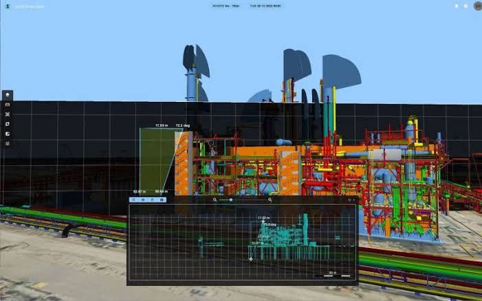
Core Technological Features Of The Octave Alto Twin Platform
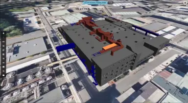
Multi-Source Data Integration Via Alto Server And Browsable Data Catalog
- Unifies static, dynamic, and real-time data seamlessly into a single digital twin powered by Alto Server.
- Supports extensive technical formats including CAD and BIM models, raster and vector formats, point clouds, reality meshes, and 360 panoramic imagery.
- Ingests data compliant with OGC data exchange standards and connects directly to existing enterprise systems such as ERP platforms managing work orders or permits via custom connectors.
- Provides a browsable Data Catalog that enables users to search, filter, and apply custom preference labels across datasets originating from different departments.
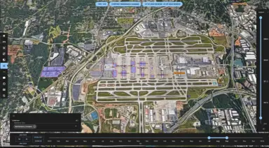
Intelligent Dimensions-Based User Interface
- Delivers an intuitive dimensions-based interface that lets users interact directly with relevant subsets of complex facility data.
- Utilizes the time dimension via an interactive timeline to filter and inspect historical, current, or scheduled data conditions.
- Applies position-related dimensions for precise geospatial filtering, scaling smoothly from multi-acre site overviews down to a single valve.
- Enables visualization through custom dimensions based on user-defined attributes, allowing teams to inspect a single pipe to view its internal material and last maintenance date within the same view.
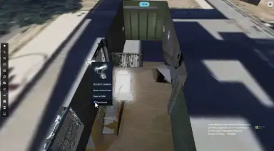
GPU-Accelerated 2D And 3D Map Visualization
- Employs GPU-optimized 2D and 3D maps that allow users to explore entire industrial facilities effortlessly or zoom into individual assets with high projection accuracy.
- Displays reality meshes, point clouds, and 3D models alongside live operational data to form a complete picture of the site.
- Supports customizable styling for raster data, vector layers, point clouds, and meshes based on specific data attributes.
- Incorporates custom clustering and declustering algorithms to help engineering teams easily interpret and navigate dense datasets.
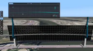
Analytical, Measurement, Slicing, And Dataset Comparison Tools
- Features a Cross-section View tool that enables clear visual interpretation of dataset heights and vertical infrastructure profiles.
- Includes an interactive Measurement Tool to perform accurate distance and area calculations directly within the 2D or 3D map environment.
- Provides a Slicing Tool to visually filter and section complex models, helping users focus on and understand the interior of large datasets.
- Offers a Dataset Comparison Slider alongside dashboards and thematic maps to compare multiple datasets, timelines, or site conditions side by side on the map.
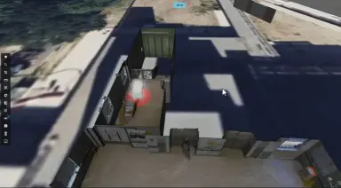
Live IoT Sensor Feeds, Real-Time Tracking, CCTV, And Automated Alerts
- Ingests real-time feeds from IoT sensors to continuously monitor equipment performance and site environmental conditions.
- Integrates real-time location tracking systems to visualize the live positions of personnel and moving assets across the facility.
- Streams live security camera feeds (CCTV) and enterprise emergency alerts directly into the 3D digital twin environment.
- Generates automated notifications that convert raw sensor streams into actionable intelligence for immediate incident response.

Built-In Authentication, Role-Based Access Control, And Permit Handling
- Embeds built-in authentication and authorization controls directly within the browsable data catalog and operational workspaces.
- Aligns seamlessly with the organization's existing user management and identity systems to enforce access rights based on permitted users, groups, and roles.
- Ensures all authorized personnel access the exact same up-to-date version of available datasets while restricting sensitive layers to approved users.
- Provides an integrated system to handle work permits, strengthening operational security and regulatory compliance across the site.
Core Business Values And Operational Benefits Of Deploying Octave Alto Twin
Tangible operational advantages that empower enterprises to maximize site efficiency, protect workforce safety, and optimize technology investments.
Eliminate Data Silos And Unify Cross-Departmental Information
- Reduces siloed information across engineering, operations, maintenance, and safety departments through cost-effective data federation.
- Simplifies access to complex site data within one unified application, helping all users rather than just GIS professionals find exactly what they need.
- Saves substantial engineering time by eliminating the need to jump back and forth between disconnected software tools.
- Maximizes existing IT investments by connecting expert systems without replacing them, streamlining workflows across the entire organization.
Accelerate Decision-Making And Minimize Facility Downtime
- Enables faster, better-informed operational decisions by combining real-time feeds, intuitive 3D visuals, and a common operating picture.
- Reduces unplanned downtime across critical infrastructure by helping teams detect anomalies and operational bottlenecks early.
- Improves maintenance planning and execution by allowing engineers to inspect asset attributes, material types, and maintenance records remotely before going onsite.
- Empowers onsite teams to perform their jobs effectively with instant access to visualized information from anywhere on the facility at any time.
Enhance Workforce Safety And Optimize Emergency Response Workflows
- Improves emergency response and safety workflows by continuously monitoring people, critical assets, and environmental conditions in real time.
- Equips onsite teams to react immediately to unforeseen events through automated notifications and live geospatial tracking.
- Mitigates operational hazards in complex environments by integrating permit handling systems directly into daily site workflows for increased security.
- Brings shared situational awareness to all stakeholders, ensuring command centers and field personnel operate from the exact same live visual information.
Protect Sensitive Site Information And Maintain Enterprise Data Integrity
- Protects sensitive site and infrastructure information against unauthorized access through built-in authentication and permission controls.
- Ensures each user views only the specific datasets and workspaces relevant to their operational role, eliminating clutter and security risks.
- Maintains strict data integrity across large organizations by guaranteeing all permitted users work from the same synchronized version of available datasets.
- Supports secure cross-departmental collaboration while upholding corporate governance and authorization standards.
Key Industries And Critical Infrastructure Sectors Served By Octave Alto Twin
Purpose-built to manage complex, closed environments with intricate assets that demand high performance and uncompromising safety.

Oil, Gas, And Chemical Refineries And Production Facilities
- Visualizes intricate refinery infrastructure from a sitewide bird's-eye overview down to individual pipes, tanks, and control valves.
- Enables engineers to interact with a single pipe in 3D to verify the hazardous material it contains and check its last maintenance date instantly.
- Enforces strict safety compliance through integrated work permit handling and real-time location tracking of field personnel in high-risk zones.
- Combines live IoT sensor telemetry and CCTV feeds to detect anomalies early and guide rapid emergency response procedures.

Heavy Equipment Manufacturing Plants And Industrial Facilities
- Integrates factory CAD and BIM models with ERP work order systems into a unified 3D operational picture to eliminate departmental silos.
- Tracks the real-time location and operational status of heavy equipment, material handling vehicles, and onsite teams across the factory floor.
- Utilizes 3D measurement, cross-section, and slicing tools to support facility layout planning, equipment retrofitting, and maintenance decisions.
- Reduces production downtime by giving maintenance crews instant mobile access to asset specifications and historical records right onsite.

Large Sea Ports, River Ports, And Airport Infrastructure
- Provides a georeferenced 2D and 3D sitewide overview capable of handling massive point clouds and reality meshes across sprawling ports and airports.
- Combines static digital terrain and utility networks with dynamic asset tracking and real-time security camera feeds in one view.
- Strengthens perimeter and terminal security by correlating automated alerts with live CCTV streams and personnel locations on the 3D map.
- Facilitates seamless collaboration across port authorities, terminal operators, maintenance teams, and emergency responders with role-based data access.
Frequently Asked Questions About The Octave Alto Twin Platform
Clear answers to common technical and operational questions from engineers and facility managers evaluating Octave Alto Twin.
Clarification regarding the commercial rebranding and corporate evolution of the platform.
- – HxGN Smart Sites has officially been rebranded as Octave Alto Twin under Octave, a global leader in enterprise software.
- – The platform retains all the proven capabilities of HxGN Smart Sites while expanding its ability to unify static, dynamic, and real-time data into one 3D operational picture.
- – Organizations in Vietnam currently operating HxGN Smart Sites or evaluating Octave Alto Twin receive full local technical consultation and support through TrueTech.
Explanation of the platform’s open data architecture and compatibility with legacy IT infrastructure.
- – Yes, Octave Alto Twin seamlessly integrates with existing enterprise systems and workflows through Alto Server and custom connectors.
- – It connects directly with ERP systems managing work orders or permits, geospatial servers, relational databases, IoT sensor networks, and CCTV systems.
- – The software supports an extensive array of formats including CAD, BIM, raster, vector, point clouds, reality meshes, 360 panoramic imagery, and OGC standards.
Overview of how field personnel utilize the application to improve efficiency and safety on the ground.
- It provides onsite teams with a single, intuitive application accessible from anywhere onsite at any time to visualize necessary operational information in real time.
- – It equips field personnel with real-time location tracking, interactive 2D and 3D maps, and automated notifications to react immediately to unforeseen events.
- – Its dimensions-based interface helps users who are not GIS professionals quickly locate specific asset information, such as pipe materials and maintenance dates, without noise.
Scope of infrastructure environments and scale supported by the spatial intelligence platform.
- – No, while it excels in industrial manufacturing and refineries, Octave Alto Twin is built for any complex environment with critical infrastructure.
- – It scales effortlessly from factory floors and heavy equipment plants to large sea ports, river ports, airports, and entire urban infrastructure networks.
Role of real-time situational awareness in managing site incidents and protecting personnel.
- – Yes, supporting faster and safer emergency response is a core capability of the Octave Alto Twin platform.
- – By ingesting live IoT sensors, personnel tracking, CCTV feeds, and enterprise emergency alerts into a shared 3D common operating picture, it enables command teams and onsite responders to coordinate immediate, informed action.
How Octave Alto Twin complements and extends the value of established geospatial systems.
- – No, Octave Alto Twin connects to your existing GIS and expert systems without replacing them.
- – It federates GIS layers alongside BIM models, point clouds, and real-time operational feeds into an intuitive 3D interface, making geospatial intelligence accessible to the entire organization.
Information regarding deployment flexibility and how to obtain tailored licensing quotations.
- – Octave Alto Twin offers flexible deployment options built around the Alto Server and Web Client architecture to match your organization’s security and scale requirements.
- – For detailed licensing models, user tier structures, and customized commercial quotations: Contact TrueTech for more details.
Contact TrueTech For Expert Consultation And Octave Alto Twin Quotations
Connect with TrueTech's engineering specialists today for a tailored technical assessment, live software demonstration, and implementation roadmap for your 3D Digital Twin.

