Improve your productivity with VisionLidar
Save Time
Classify your objects 3x faster and focus on the most important aspects of your projects, in just a few steps.
Save Money
Maximize your budget with a complete software.
Enhance your ROI
Get the most out of your investment after only 3 months of usage thanks to the efficient workflow VisionLidar provides.
Process point clouds and 3D images of aerial, terrestrial and mobile Lidar data.
Dynamic 3D Fence
The dynamic 3D fence allows you to select parts of your point cloud thanks to an interior or exterior delimitation. The selection can be saved and used with different tools like editing, deleting, exporting, segmentation, classification, surface analysis, dendrometry, and cylinders and plans detection. It’s also possible to export parts of your point cloud into .E57, .LAS, .LAZ, and .PTS formats.
Adaptive cross section template
Vectorize complex 3D infrastructures with a few clicks. Roads, tunnels, and other 3D structures can be captured and converted to your CAD with the adaptive 3D and cross section template tool. Multiple alignments can be managed at the same time using different 3D templates. Cross section can be copied to the next station or interval. The user can select single or multiple points or vertex to visualize and adjust the selection to a 3D road, bridge, or tunnel. This tool also helps you create lineworks with feature codes, as well as breaklines for surface exportation into .DXF or Shape File formats.
Image and video creation
Create images, videos, and fly-throughs in your point cloud. With this tool, you can easily produce an image and save it in .PNG format. Create an intuitive time-based fly-through video in .AVI format in just a few clicks.
Color shading for surface analysis
Colorize surfaces like buildings, DTM, or any plans to visualize the deviation of the Point Cloud in different colors.
Model geometry
Extract contour lines, mesh, surfaces, planes, cylinders, trees, sidewalks, buildings, pavement lines, or any other model geometry to efficiently vectorize them. With or without a 3D fence constraint, it can easily be exported into .DXF or Shape file formats, or as a Vision Database.
Point Cloud comparison
Compare a part of two full LiDAR scans and identify their differences, then export a .PDF report. This function is adapted for building surveillance with its statistical shift tool.
Online visualization
Export to Potree to visualize and publicize your Point Cloud online. This tool allows you and your clients to easily view, measure, and annotate any Point Cloud from a Web browser.
Tree measurements
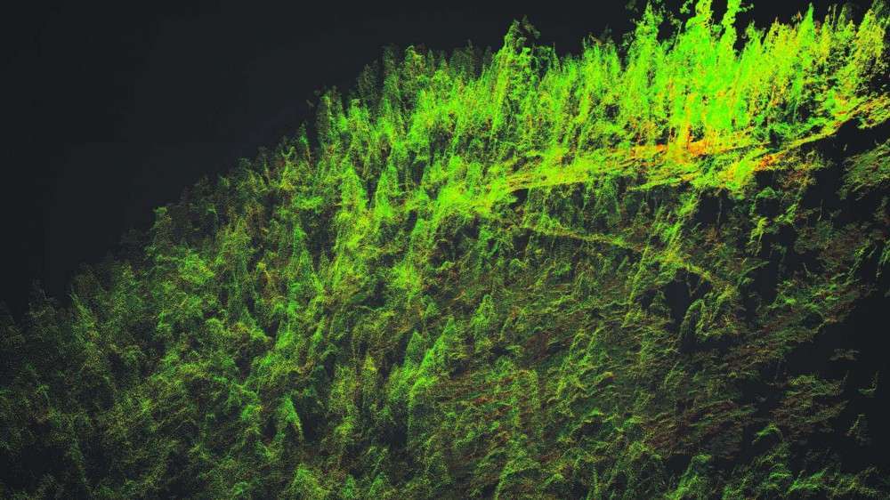
Select a region or a part of the Point Cloud using the 3D fence tool and automatically select and measure a tree height, trunk diameter, crown surface and crown diameter, from chest height. You can also choose to apply a constraint on a bare earth surface or not.
Point Cloud Management
Segment and filter your Point Cloud using the layer tool. VisionLiDAR can manage up to 128 layers to isolate parts of your scan areas for detailed editing. Rename the layers in compliance with the standards you are using such as DOT or CAD. Also visualize your Point Cloud in RGB, Normal, Scans, Intensity, Class, Wireframe, Color Shading, or Elevation. It helps you simplify your Point Cloud by eliminating irrelevant points without diminishing its accuracy.
Registration
Use a dynamic registration of Point Clouds tool to control your data and merge your scans using a least squares method.


